

Drone by Drone’s big fleet is comprised by multicopter and fixed wings drones to serve for Archeological purposes, in which they provide an essential tool for the following works:
- Monitoring of civil works in order to plan archaeological actions, or the impact of civil works on archaeological sites.
- Aerial photography for collecting documentation of the archaeological works through very detailed photographs, so as to produce a total or partial panorama of the archaeological site. Valuable orthophotos can be made using our techniques and photogrammetric software.
- Prospecting of big areas in order to find possible remains, which can be combined with 3D modelling of the lands where an archaeological action (prospections, surveys, diggings, etc.) can take place.
- Aerial Archaeological sites monitoring to determine their possible alterations (because of farming activities, vandalism, vegetation advance, natural motives, etc.), which allows for planning the most suitable actions.
- 3D ground modelling prior and after the dig so as to check and cubicate the performed ground movement.
- Documentation of the architecture of archaeological constructions, allowing the reading of faces in high and difficult to reach zones.
- Remains location in the intertidal zone for maritime archaeology.
- Aerial landscape documentation for its GIS/SIG photographic use.
Our co-workers are highly specialized in archeology.
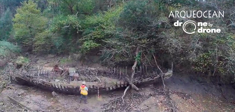
Collaboration with Aqueocean. Wrecks in the river Lea
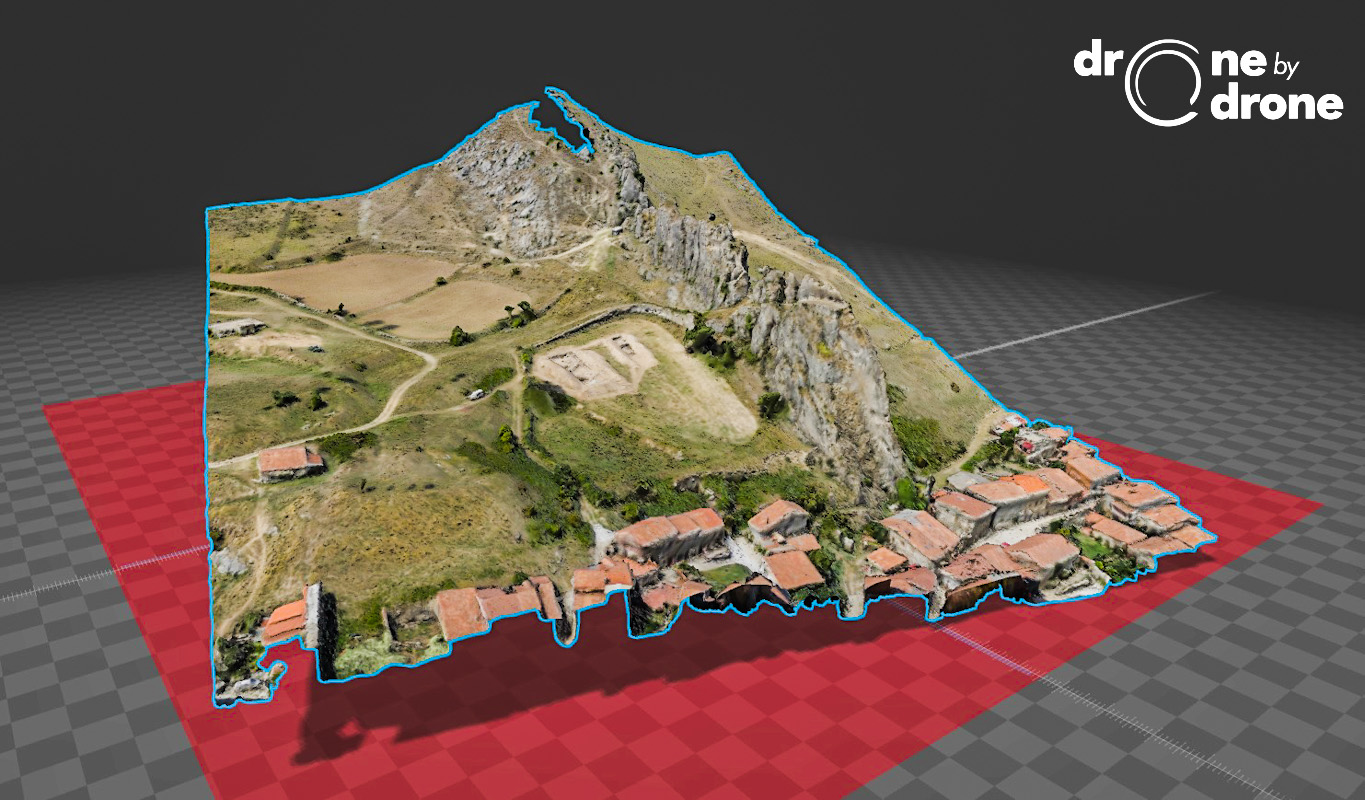
3D modeling of archaeological site in the Castle of Santa Marta in Pancorbo